
📊 Full opportunity report: The City That Watches Itself: The Living Digital Twin, And The God’s-Eye View We’re Building on ThorstenMeyerAI.com — validation score, market gap, and execution plan.

Get the little things that make your day delivered free with Prime
- Fast, free delivery on millions of items
- Prime Video, Amazon Music and more included
- Member-only deals all year
TL;DR
Cities are creating real-time, dynamic digital twins that integrate sensor data, satellite imagery, and AI to monitor urban environments. This technology enhances planning but raises significant surveillance concerns. The development is ongoing, with key implementations in Singapore and other cities.
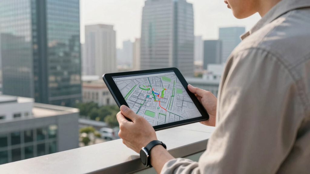
Urban digital twins are evolving into dynamic, real-time models that integrate data from sensors, satellite imagery, and AI, enabling cities to monitor and simulate their environments continuously. This development marks a significant shift in urban management, offering both improved planning and operational insights.
Recent advances in sensor technology, satellite imagery, and artificial intelligence have made it possible to create digital replicas of cities that update in real time. These models, such as Singapore’s Virtual Singapore, now incorporate live data streams from IoT devices, wide-area motion imagery (WAMI), and all-weather radar, creating a comprehensive virtual environment that reflects current conditions.
WAMI sensors, which track vehicles and pedestrians, archive movement data that can be revisited and analyzed for urban planning and management purposes. When combined with AI capable of understanding complex data patterns, these digital twins become queryable, allowing officials to ask questions like, ‘Where did this vehicle go last Tuesday?’ or ‘What would happen if this levee failed?’—facilitating data-driven decision-making.
This technological integration shifts the role of digital twins from static models to active tools for urban governance, supporting planning, resource allocation, and emergency response. However, these systems also raise concerns related to privacy and data sovereignty, as they can be used for surveillance purposes.
The city that watches itself: the living digital twin, and the god’s-eye view we’re building
Soon most cities will exist twice — once in concrete, once as a live data model you can rewind, simulate, and question in plain language. Persistent sensing + frontier AI turn the planner’s digital twin into an oracle. The most useful thing we’ve built — and the most powerful surveillance instrument. Both at once.
- Plan better — cities & rural: traffic, zoning, energy, land use
- Emergency response — route crews, one live picture, ~50% faster
- Disaster resilience — simulate, track live, assess damage in hours
- Mass surveillance — track everyone, retroactively, forever
- Pattern-of-life — AI links movements, infers associations
- Social control — no warrant, no suspicion (cf. Baltimore, 2021 ruling)
We’re building a city that watches itself, remembers everything, and can be asked anything. The technology won’t choose between saving lives and ending privacy — we will, through the rules we write now, while the twin is still under construction and the defaults haven’t yet hardened into permanence. WAMI and the living twin open our lives to a view from the heavens that, from the dawn of civilization until a heartbeat ago, was reserved for gods and stars. The question is no longer whether we can see everything — it’s who gets to look, and who watches the watchers.
Implications for Urban Governance and Privacy
The development of real-time, AI-driven digital twins has the potential to improve urban management and planning processes. Nonetheless, these systems also introduce challenges related to privacy, surveillance, and data control, necessitating careful governance and regulatory oversight.
As an affiliate, we earn on qualifying purchases.
Technological Foundations and Recent Progress
The concept of digital twins has evolved from static models used for urban planning to dynamic, real-time systems enabled by advances in sensors, satellite radar, and AI. Cities such as Singapore, Helsinki, and Las Vegas now operate digital twins that provide continuous updates, with Singapore’s model extending to subsurface infrastructure mapping.
The recent progress has been driven by AI models capable of processing large, heterogeneous data streams and enabling natural language queries and complex simulations. This technological evolution is ongoing, supported by advancements in AI capabilities like GPT-5.6 and similar models.
“The convergence of sensors, satellite data, and advanced AI is enabling new forms of urban data analysis and management.”
— Thorsten Meyer, AI researcher
As an affiliate, we earn on qualifying purchases.
Unresolved Challenges and Risks
It remains uncertain how widely digital twin systems will be adopted, how governance frameworks will evolve, and how privacy concerns will be addressed globally. Ensuring appropriate oversight and preventing misuse are ongoing challenges, particularly as AI models are developed and controlled by various entities.
As an affiliate, we earn on qualifying purchases.
Next Steps in Development and Regulation
Further integration of AI and sensor data is anticipated, with more cities exploring digital twin implementations. Development of regulatory standards and international agreements will be important to address privacy, sovereignty, and ethical considerations. Monitoring how these systems influence urban governance and civil liberties will be essential.
AI-powered city management systems
As an affiliate, we earn on qualifying purchases.
As an affiliate, we earn on qualifying purchases.
Key Questions
What is a digital twin in a city?
A digital twin is a virtual, real-time model of a city that integrates sensor data, satellite imagery, and AI to monitor and analyze urban environments continuously.
How does AI enhance the capabilities of city digital twins?
AI enables digital twins to interpret complex data, answer natural language questions, simulate scenarios, and provide insights that support urban decision-making.
What are the privacy concerns associated with digital twins?
Because these systems can track individual movements and behaviors, there are concerns about surveillance, data security, and potential misuse if not properly regulated.
Which cities are leading in digital twin development?
Singapore, Helsinki, and Las Vegas are among the cities with operational digital twins, with Singapore’s system being notably advanced.
What is the future of digital twins in urban management?
Further adoption, enhanced AI integration, and the development of regulatory frameworks are expected to shape the future of digital twins in cities.
Source: ThorstenMeyerAI.com
NFL season / tailgating Picks
team gear
As an affiliate, we earn on qualifying purchases.